Maps of Texas: Five Rare Books for Collectors
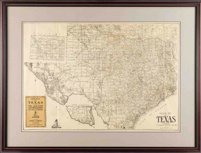
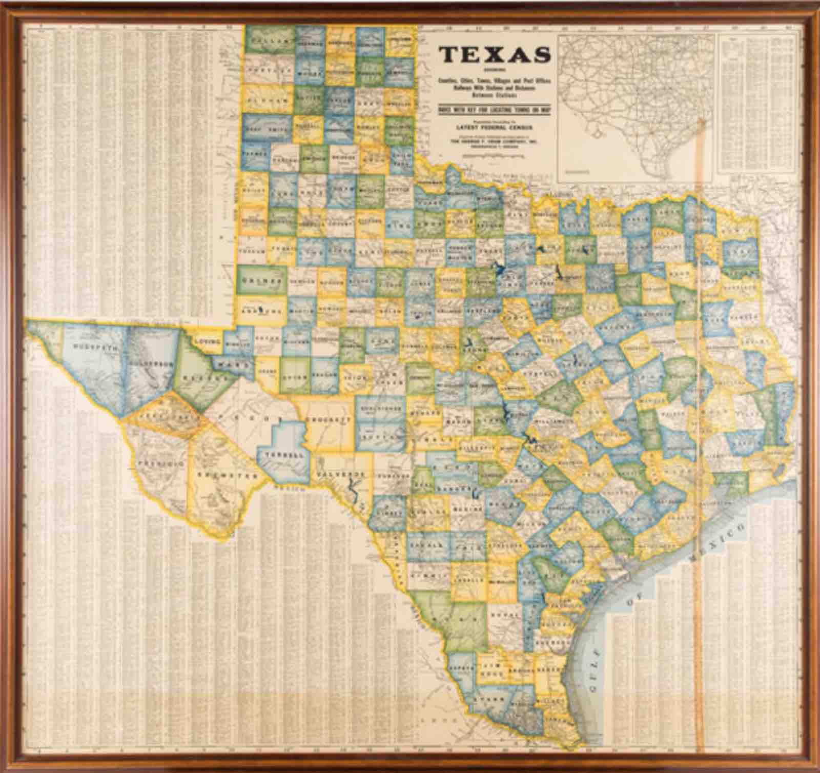
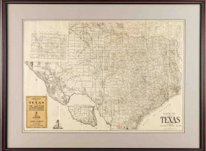
F. E. Gallup. Gallup's Map of Texas, Showing Oil and Gas Fields, Pipe Lines and Refineries


Highlights from Heritage Auctions' Historical Manuscripts including Texana on August 8 include:
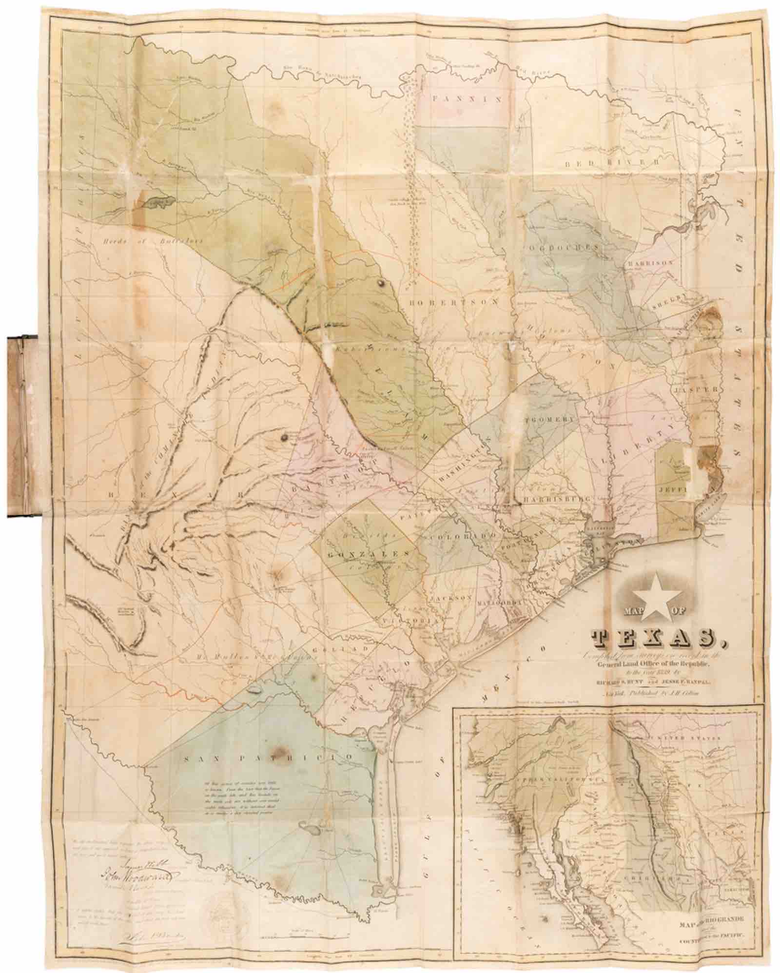
Richard S. Hunt and Jesse F. Randel, Map of Texas (New York: J. H. Colton, 1839)
Locations of the original Texas colonies and early county configurations are presented along with geographic features and locations of settlements and Indian groups. One of the earliest to show the newly incorporated city of Austin. With period ownership signature "N Clopper," possibly Nicholas Clopper, an early settler who first arrived in Stephen F. Austin's colony circa 1822.
John Arrowsmith. Map of Texas (London: April 17, 1841)
Drawn from official surveys filed with the Texas General Land Office, Arrowsmith's map provided the most accurate and detailed representation of Texas available in Britain at the time. It bears a printed note stating that Great Britain recognizes Texas as an independent state - the map aimed to legitimize Texas as a sovereign nation, support diplomatic recognition, and encourage emigration and land investment by showcasing its geography, settlements, and resources.
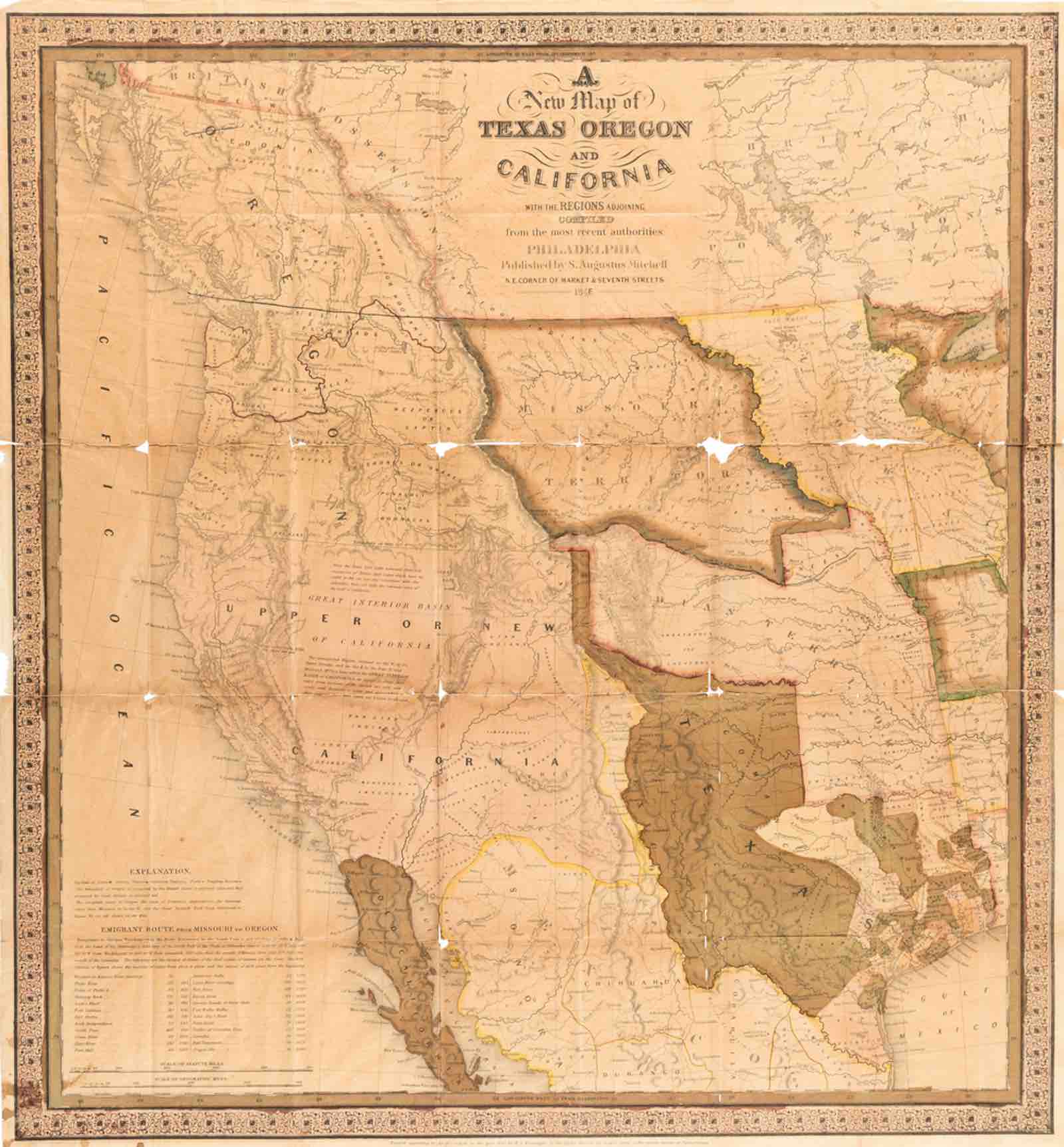
Samuel Augustus Mitchell. A New Map of Texas, Oregon and California with the Regions Adjoining (Philadelphia: S. Augustus Mitchell, 1846)
Written on the eve of the Mexican-American War, this booklet was "Entered according to the Act of Congress in the year 1845, by S. Augustus Mitchell, in the clerk's office of the District Court of the Eastern District of Pennsylvania." Much of the territory depicted in this map was part of the United States by 1848.
F. E. Gallup. Gallup's Map of Texas, Showing Oil and Gas Fields, Pipe Lines and Refineries (K.[ansas] C.[ity]: F. E. Gallup Map Co., circa 1920)
A scarce geological map depicting the oil and gas industry of its time. Oil fields and refineries are clearly identified by name and marked in faint red type, with pipelines connecting them also illustrated.
Dallas Texas by George F. Cram (Chicago: George F. Cram, 1898)
From Cram's Universal Atlas showing cemeteries, parks, and the trolley car routes